Projects & Publications
Current Projects

Multi-platform and multi-temporal remote sensing data for characterizing environmentally significant properties of wetland ecosystem
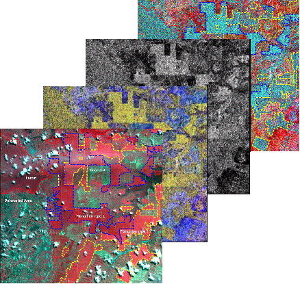
Wetlands are areas that are saturated or inundated for a period of time long enough to support an ecosystem that sustains unique communities of plants and animals. They have various hydro-ecological and socio-cultural functions and services such as but not limited to provisions of habitat for wildlife, supply water for crop irrigation and domestic animals, control flooding and improve surface water quality. Wetlands can also serve as a valuable site for recreation, education, research and cultural heritage. Nonetheless, despite all these values and functions, the physical and hydrological conditions of wetland ecosystems are under immense pressure from various anthropogenic and/or environmental stressors. This project is designed to characterize dynamic environmentally significant properties of wetlands’ ecosystem (e.g., number of wetlands, surface area, hydro-periods) and the surrounding uplands with an integrated multi-platform and multi-temporal Remote Sensing (RS) data. The hypothesis is that the remote sensing tools can identify, recognize, measure, describe and explain these properties at multiple spatial scales.
 A Geospatial Assessment of the Distribution, Condition and Vulnerability of Wetlands in Tennessee
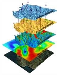
Several hydro-ecological, socio-economic and cultural values of wetlands and their unique vulnerability to the impacts of land use and climate change necessitate the need for their protection. Tennessee State has lost almost 60% of its original wetland resources and there is existent pressure of climate and land use change. Wetlands are extremely sensitive to the impacts of climate changes and development projects consider wetlands relatively less productive. The main goal of this project is to conduct a geospatial assessment of wetlands abundance, distribution, condition and vulnerability at landscape scale. Multi-platform and multi-temporal remote sensing data will be used to characterize wetlands’ hydrologic connectivity and water regime type, while GIS data of active and looming environmental and anthropogenic impacts will be used to assess the protection status, conditions and vulnerability of the wetlands. A compressive assessment of wetland resources is critical for guiding decisions with regard mitigations of wetlands threatened by unavoidable public or private developmental projects. State of Tennessee has enacted “no net wetland loss” legislation since 1990, which requires the protection existing wetlands and/or replacement of the ones that are lost.
Publications
PEER-REVIEWED JOURNAL PUBLICATIONS
Gala TS , Young D and A, Melese (2014, Submitted) Geographically Isolated Depressional Wetlands – Hydrodynamics, Ecosystem Functions and Conditions, Journal of Environmental Management.
Dessalegn D, Beyene S, Ram N, WalleyF and Gala TS, (2014) Effects of topography and land use on soils characteristics along the toposequence of Ele Watershed in Southern Ethiopia. Catena Journal 115: 47 – 54.
Gala TS (2012) Characterizing Surface and Near-Surface Water: Satellite-based Mapping on the Natural Grasslands of the Prairie Pothole Region, Central Canada, ISBN: 978-3-659-22907-7, LAP LAMBERT Academic Publishing, Saarbrücken, Germany.
Gala TS , CarlyleS and Trueman R (2012) Soil Hydrodynamics and Controls in Prairie Potholes Region, Central Canada. Area Journal, 44(3): 305 - 316
Gala TS and Melesse A (2012) Monitoring prairie wet areas with an integrated LANDSAT ETM+, RADARSAT-1 SAR and Ancillary DEM Data from LIDAR. Catena 95: 12 – 23.
Gala TS, Carlyle S, Aldred D and IF Creed (2011) Topographically based spatially averaging of SAR data improves performance of soil moisture model. Journal of Remote Sensing of the Environment115(12): 3507 - 3526.
Gala TS, Pazner M and Beyene S (2011) Evaluating biophysical attributes of environmentally degraded landscapes of Adwa district, Northern Ethiopia using LANDSAT ETM+ and GIS. EJESM 4 (1): 1 - 16.
CONFERENCE PAPERS, POSTERS AND PRESENTATIONS
Gala TS
(2013) Cases for Oromo-Ethiopian Youth Association in Canada. The 2nd Annual African Conference at Tennessee State University, September 13, 2013, Nashville, TN, USA
Gala TS, Pazner M and Beyene S (2011) “Landscape analysis of environmentally degraded Ethiopian highlands using LANDSAT ETM+ and GIS.” Environmental Research Western, Abstract published on the Bulletin of 8 th Annual Earth Day colloquium, April 14 – 15, 2011, The University of Western Ontario, London, Canada.
Gala TS (2010) “Monitoring the snow-free period’s hydrology of prairie wetlands: a multi-temporal analysis of Landsat ETM+, Radarsat-1 SAR and Ancillary DEM from LiDAR.” Book of Abstract of the CACONT 2010 Annual Meeting, October 15 – 16, 2010, Ryerson University, Toronto, Canada.
Gala TS and Creed IF (2010) “Combinatory power of optical and radar imagery for dynamic wet area mapping.” Abstract published on the booklet of Canadian Geophysical Union annual meeting, May 31 – June 04, 2010, Ottawa, Canada
Gala TS and Creed IF (2010) “Improved prediction of soil moisture using a physical basis for spatial averaging of synthetic aperture radar.” Abstract published on the booklet of the Canadian Geophysical Union annual meeting, May 31 – June 04, 2010, Ottawa, Canada.
Gala TS and Creed IF (2010) “Prairie wetland mapping and classification: A Multi-temporal analysis of RADARSAT-1/LANDSAT TM data.” Environmental Research Western, Abstract published on the Bulletin of 7 th Annual Earth Day colloquium, April 23, 2010, The University of Western Ontario, London, Canada.
Gala TS and Creed IF (2009) “Soil hydrodynamics and controls in the landscapes of prairie pothole” 7th Institute of Wetland and Waterfowl Research (IWWR) symposium Oak Hammocks Marsh, Manitoba, Canada
Gala TS and Creed IF (2009) “Mapping soil moisture of the prairie potholes region using a hybrid LiDAR/RADAR approach.” 7th Institute of Wetland and Waterfowl Research (IWWR) symposium Oak Hammocks Marsh, Manitoba, Canada.
Gala TS (2008) Soil moisture estimation from RADARSAT-1 data on topographically heterogeneous Landscape of Canadian prairie potholes region, Eco-Hydrological Modelling workshop (June 18 – 20, 2008), The University of Western Ontario, London
Gala TS (2008) “Soil moisture estimation for the Prairie Potholes Region of central Canada from RADARSAT-1 Data.” Environmental Research Western, Abstract published on the Bulletin of 6th Earth Day colloquium, April 17, 2009, The University of Western Ontario, London.
Gala TS (2007) “A radar based tool for mapping hydrologically sensitive areas in prairie potholes region of central Canada.” Environmental Research Western, Abstract published on bulletin of 4th Earth Day colloquium, April 20, 2007, The University of Western Ontario, London, Canada


